We left Bedourie early Sunday morning headed for the famous Outback settlement of Birdsville, just north of the Queensland/South Australia border. It was a muddy drive along the sections of road between the towns that were unpaved (roughly 65% of the track is paved), the clay floodplains holding on to the water from the torrential rains of the previous week. The waterholes along the way were alive with birdlife, birds like pelican and spoonbills that we didn’t expect to see more than 1500 kilometers (930 miles) from the coast on the edge of the Simpson Desert.
 The Simpson and Strzelecki Deserts are located on the edge of the Great Artesian Basin, a massive underground aquifer covering almost a third of Australia’s landmass. It’s the largest aquifer system on the planet. In many places on the edge of the deserts the water rises to the surface piping hot, we stopped off at one of the heated artesian wells alongside Cacoory Ruins roughly halfway between Bedourie and Birdsville. Our visit to the beautiful Dalhousie Springs along the Oodnadatta Track when we stated this adventure last June was another heated spring rising from the Great Artesian Basin. The water at the Cacoory bore rises from the depths at 85°C (185°F), definitely too hot for a dip and we were sure to steer clear of the actual bore pipeline as it sounded to be under some serious pressure. The water was crystal clear as it snaked its way through the desert, letting off steam into the surrounding air as it cooled in the brisk winter temperatures.


 Birdsville must be one of the most remote towns in the country: perched between the Simpson Desert to the west, Strzelecki Desert to the south and endless expanses of Queensland’s Channel Country to the
  north and east. Today Birdsville serves as a restocking and refueling point for tourists crossing the deserts on 4WD expeditions, as well as a supply base for some of the surrounding cattle stations. As remote Outback towns go, Birdsville had a lot to offer: a full service caravan park, two petrol stations, post office, historic pub and the Birdsville Bakery. And I should mention that the Birdsville Bakery is licensed. Yes, all my Christmases came true at once in the middle of the desert: a bakery that serves beer. We didn’t take too long to sniff out the bakery once arriving in town, an exceptionally well-maintained establishment with excellent pies and fantastic atmosphere. While we didn’t visit during the evening – instead opting for the pub – the bakery advertised campfires out the front each evening, often with free entertainment. After being very disappointed in general with the pies in Queensland, it was a breath of fresh air to taste the pies at the Birdsville Bakery, someone knew what they were doing. The kangaroo and claret pie was great, as was the chunky beef offering. We were in town for 20 hours and had two meals at the bakery!


 We shacked up at the Birdsville caravan park (S25°53.997’ E139°21.244’) for the night, enjoying a hot shower and afternoon run through the wetlands on the edge of town. With so much 4WD country around Birdsville it’s no surprise that the roadhouse was home to the toughest looking 4WD recovery vehicle either of us had ever seen. Built like a Sherman tank with tyres of
  at least 60 inches (152 centimeters) in diameter, this rig was a serious piece of machinery. I’d hate to think of the price tag attached to a recovery callout for this bad boy!
 The Birdsville Hotel was established more than a century ago in 1884. A beautiful old building with a couple of bars, beer garden, formal dining hall and plenty of characters around the bar it was a great spot to spend the evening. On Sundays the hotel has a weekly roast, we put down $20 each for a scrumptious dinner of beef and lamb with all mandatory roast dinner sides. Not quite as good as my grandmother’s roast lamb but it was a great meal. The hats in the photo below were all nailed to the roof by invitation of the hotel, to have your hat put on display it’s mandatory that you spend a minimum of one calendar year in town without leaving.


 The usually barren clay floodplains on the drive out of Birdsville were alive with colour as we left early Monday morning, the unseasonal rain filling the land with beautiful hues of green and wildflowers as far as the eye could see. We passed through some amazingly thick fog on our way to the Cordillo Downs Road turn-off, tackling a good portion of the 116 kilometers (72 miles) from Birdsville without seeing more than a few meters in front of The Tank’s bull bar. From the Cordillo Downs turn-off we passed alongside the massive expanse of Moonda Lake before setting wheels on familiar ground for the first time since January: back in South Australia.

 Over the border we found ourselves in the Strzelecki Desert proper, at the same time being on the property of Cordillo Downs Station. The size of Cordillo Downs boggles the mind, we drove over 100
 kilometers and were still – as far as we could tell – on the station’s property. Steeped in history, the station is a huge cattle enterprise these days. In the past it was one of the largest sheep stations in the country and is still home to Australia’s largest sheep shearing shed. The shed is no longer used as today the station is exclusively a cattle operation, but it was very interesting to read some of the station’s history inside the old shearing shed. In the 1800s the shearers would make a journey of four-and-a-half days by bicycle to Cordillo Downs when the sheep needed to be shorn, the station at its peak had over 30000 head of sheep. The wool, once dried, was transferred to Farina north of the Flinders Ranges by Afghan cameleers where it was taken by rail to the nearest major centre of Port August or further south to Adelaide. If only they’d waited 150 years for a Toyota LandCruiser!


 It’s 177 kilometers from Cordillo Downs to Innamincka, the road passes through some beautiful country on its way through the Innamincka Regional Reserve and Innamincka Station. Big red sand dunes typically associated with the neighboring Simpson Desert filled the horizon on our way through the northern portion of the Innamincka Regional Reserve, a beautiful part of the country. Lisa had hawk eyes when she spotted this adult Bearded Dragon on the side of the road while at the same time piloting The Tank through the sand. I’d never seen coloring on a Bearded Dragon like this one, striking yellow eyes and a jet black belly, he was surprisingly content with me taking photos of him as he lay on the sand in the middle of the desert. Maybe he’d never seen a human before…
We camped next to the shelter of a big red dune roughly 20 kilometers (12.4 miles) north of Innamincka, a picturesque spot with rolling red sand dunes to the west and a dry creek bed below. The serenity of the spot was unfortunately interrupted a few minutes after we stopped by some of the worst flies we’ve encountered on our entire trip. Plenty of expletives from Lisa and my attempts to ignore them didn’t work, Lisa finding refuge in our mosquito tent and me climbing into the Blue Room to read in the afternoon sun. As the sun waned the flies left us alone to enjoy a beautiful starry night with a few beers beside the campfire, great to be out in the open country with the surrounds to ourselves again.


 Our tranquil night amongst the dunes was interrupted at around 2:00AM with thunder, lightning and torrential rain. We hopped out of the Blue Room at around 7:30AM to find the previously dry creek bed next to us gushing with water. The ground under our feet turned to sticky mud as the rain persisted throughout the morning and into the sunlight hours. Amazing how quickly the desert changed with the onset of rain… We made it back to the road from our campsite in the pouring rain, and then the fun began. It took us almost 90 minutes to drive the 20 kilometers (12.4 miles) between our campsite and the desert outpost of Innamincka, the rain had turned the usually solid clay into slick, boot-deep mud that caked into the tread of The Tank’s tyres. I’d never driven in such trying conditions. The Tank had an absolute mind of its own, sliding all over the track especially in sections where the road had even the smallest hint of camber. We almost got stuck once as The Tank found its way into the thick mud to the side of the main track, having to crawl out with differential locks engaged. Saying I was on edge as we made our way through the mud in the rain would be an understatement! I would have loved to take some photos of our 20 kilometer journey, but I have no doubt that if we stopped in some of the hairier sections we would have been well and truly bogged until the storm passed!
 As we rolled into Innamincka (S27°44.783’ E140°44.292’) the rain showed no sign of subsiding, we’ve never been so excited to arrive in a Podunk town in our lives! With a few ramshackle dwellings, a homestay, roadhouse and hotel, Innamincka is even more sparse than neighboring Birdsville. As the rain flooded the surrounding roads it made leaving town impossible so we took refuge to a motel room for the day to escape the torrential downpour. We arrived at the Innamincka Hotel’s reception in the nick of time, snatching the last available room before similar travelers flocked-in for the same reason. We spent the day out of the elements with a TV, heater and a power outlet to formulate this post.


 The rain stopped at 4:00PM on Tuesday, roughly 14 hours after it began. It dumped 50 millimeters (two inches) of water on Innamincka and surrounds, enough to close the roads across the Outback from Oodnadatta to western New South Wales. So lucky we managed to score the last hotel room in town, as the day progressed on Tuesday more and more weary travelers rolled into town hoping for shelter, only to be turned away and forced to camp in the mud. At least they could seek refuge for a cold beer at the bar… We spent the afternoon watching movies on our movie channel, I don’t think we’d watched so much TV in a single day since before we left California! For dinner we enjoyed a beer at the pub and some great Aussie burgers at the Outamincka dining hall in the Innamincka Hotel. The place was absolutely packed, there wasn’t a spare seat in the whole pub and the dining hall almost packed. I bet the owners of the hotel wish for more torrential downpours!


 We woke on Wednesday morning greeted with clear blue skies and a touch of wind, close to ideal weather for drying the roads (ideal weather would be hot sun and gale force winds…). The parking areas and Innamincka’s two streets had been transformed to boggy mud by the water, the clearing in front of the pub and petrol station effectively a lake. It was tough to walk around town let alone drive a car through the mud. We were again thankful for our cozy hotel room and equally glad we had waterproof boots in which to walk around. It was amazing the number of travelers that had rolled into town in the rain the day before, the parking area in front of the pub was brimming with people camping in the mud and clearing by the creek just out of town filled with more than 20 vehicles. No hope of the roads opening Wednesday but we crossed our fingers with everyone else that we’d be able to get out within a couple of days with the change in weather.


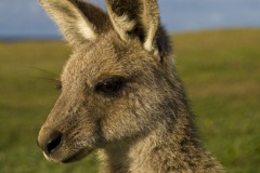
When we did finally get out it was with the advice of the truckers who were also stranded, pictured above right. Our original intended route is drawn on the maps here in blue, with the area closed by the rains shaded in red. The truckers mentioned that when the roads eventually opened, the 756 kilometers (470 miles) from Innamincka to our destination in Broken Hill would take a couple of days due to the deep mud and dangerous driving conditions. Instead, they suggested making our way out back into Queensland through Nappamerrie station and onto the bitumen roughly 50 kilometers (31 miles) from Innamincka. We took their advice and at 4:37AM left the small desert settlement of Innamincka with a target of Broken Hill by the end of the day. The green line on the maps here is the route we eventually had to take, paved roads all the way once we got off the dirt in Queensland. It was a marathon day of driving, 1429 kilometers (888 miles) in  all that took almost 18 hours from start to finish with nothing more than time off for driver changes, food and toilet stops. Across three states we had to dodge everything from Echidnas to pigs, goats, Emus and kangaroos as they scurried across the road in front of us. Needless to say, we were extremely happy to see Todd in Broken Hill when we arrived a little after 10:00PM. If we never go to Innamincka again in our lives I think that’ll be fine with us!

 This website originally started as a diary for ourselves, a way to remember our journey and share it with friends and family all over the world. While it’s served this purpose well, it’s also morphed into somewhat of a hub for travelers like ourselves planning trips to some of the places we’ve visited. Since its inception on April 14, 2009 OurWalkabout.com has received 4,150,797 (and counting!) visits from people all over the world. Traffic for everything from travelers wondering where to camp in Kalumburu to backpackers trying to decide on the best hamam in Bodrum. The site receives most of its visits from the United States and Australia, but also receives inquiries from countries as far flung as Israel, Latvia and Brazil. OurWalkabout.com will remain in its present state for the foreseeable future, we have no plans to release the domain or change the site’s setup, maybe it’ll be the home for our next adventure!


")


")